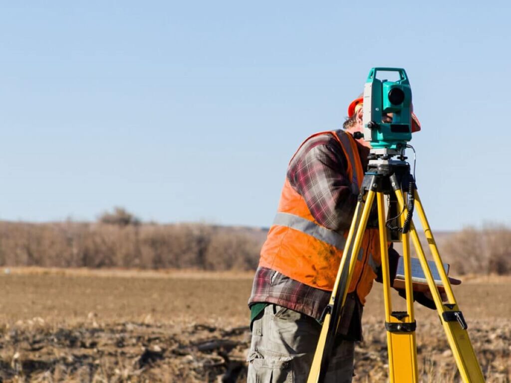
Professional surveyors are essential for successful land development and infrastructure projects in Brisbane. These skilled experts bring accuracy and knowledge to every stage of a project, from the initial assessment of a site to the final monitoring of construction.
Surveyors do much more than just take measurements. Their important responsibilities include:
- Making sure local building codes and rules are followed
- Determining property boundaries with precision
- Conducting thorough investigations of sites
- Mapping out utilities in great detail
- Creating comprehensive surveys of the land’s features
Accurate measurements are crucial for any construction or development project. Even a small mistake can result in expensive delays, legal battles, and potential safety risks. To ensure the highest level of accuracy in their work, professional Brisbane surveyors use advanced technology and methods.
In Queensland, there are strict rules that must be followed. Registered surveyors have the qualifications and knowledge needed to understand these requirements, making sure that projects meet all legal and safety standards. Their work is vital for:
- Developing properties
- Building infrastructure
- Installing utilities
- Dividing land into smaller lots
- Assessing compliance with building regulations
Choosing qualified surveyors is especially important in Brisbane’s fast-paced construction industry, where complex projects need both technical precision and adherence to regulations. These professionals offer valuable insights and expertise that protect investments and guarantee the success of projects.
Comprehensive Services Offered by Professional Surveyors
Professional surveying services in Brisbane encompass a wide range of specialised solutions designed to meet diverse project requirements. Registered surveyors deliver essential services across multiple sectors:
Property Surveys
- Boundary identification and marking
- Title re-establishment
- Subdivision planning
- Building setout surveys
Construction Services
- Site layout and positioning
- As-built documentation
- Volume calculations
- Structural monitoring
Infrastructure Support
- Road and rail alignment
- Bridge positioning
- Tunnel guidance systems
- Public utilities mapping
Utility locators form a crucial component of the surveying landscape, providing detailed underground asset mapping through:
- Non-destructive investigation methods
- Precise depth and position determination
- Comprehensive utility mapping
- Risk assessment documentation
These end-to-end services create a seamless integration between different project phases, from initial planning to final construction. The combination of registered surveyors and utility locators ensures thorough site understanding and risk mitigation across residential, commercial, and infrastructure developments.
Professional surveying teams maintain strict adherence to Australian standards and local regulations while delivering these services. Their expertise extends to working with various stakeholders, including property developers, construction companies, and government authorities, ensuring project requirements are met with precision and reliability.
Specialized Expertise of Wumara Group
Wumara Group stands out in Brisbane’s surveying landscape through its distinctive blend of technical expertise and cultural understanding. The company’s specialised services encompass two critical areas: site investigation project management and Indigenous procurement consulting.
Site Investigation Project Management
- Comprehensive site assessments
- Risk evaluation and mitigation strategies
- Environmental impact studies
- Detailed documentation and reporting
- Project timeline coordination
- Stakeholder communication management
The company’s site investigation services integrate advanced methodologies with practical experience, ensuring thorough analysis of potential development challenges and opportunities.
Indigenous Procurement Consulting
- Strategic tender development for major projects
- Cultural heritage preservation guidance
- Indigenous business engagement frameworks
- Compliance with government Indigenous procurement policies
- Partnership facilitation between contractors and Indigenous businesses
- Sustainable development practices aligned with cultural values
Wumara Group’s unique position in the market stems from its ability to bridge traditional surveying expertise with Indigenous business knowledge. This dual specialisation enables the delivery of projects that meet technical requirements while fostering meaningful Indigenous participation in the construction and infrastructure sectors.
The organisation’s approach to major project tendering incorporates:
- Detailed market analysis
- Risk assessment frameworks
- Strategic partnership development
- Cultural sensitivity protocols
- Compliance documentation
- Performance monitoring systems
This comprehensive service offering positions Wumara Group as a valuable partner for organisations seeking to enhance their project outcomes through culturally informed and technically sound practices.
Market Presence and Client Feedback Analysis
The surveying landscape across the NSW and QLD markets demonstrates a robust professional network, with Brisbane-based surveyors extending their reach throughout both regions. Professional surveying services maintain a strong presence in metropolitan Brisbane, while simultaneously serving regional areas across both states.
A detailed market analysis reveals:
Brisbane Metropolitan Area
- High concentration of surveying firms
- Diverse range of specialised services
- Strong competition driving service quality
Regional Coverage
- Extended service reach to remote QLD locations
- Cross-border operations into NSW territories
- Adaptable service delivery models
The geographical spread of surveying services creates distinct advantages for clients:
“The ability to access professional surveying services across state lines ensures project continuity and consistent quality standards” – Industry Analysis Report 2023

Market data indicates a growing demand for surveying services in:
- Infrastructure development
- Commercial construction
- Residential subdivisions
- Mining and resources sectors
Professional surveyors in Brisbane have established strategic partnerships with:
- Local councils
- State government departments
- Private developers
- Construction companies
This extensive market presence enables surveying firms to maintain competitive pricing structures while delivering high-quality services across diverse geographical locations.
Positive Client Feedback and Competitive Pricing Strategies
Client testimonials consistently highlight the exceptional service standards maintained by Brisbane’s surveying professionals. Recent feedback analysis reveals key strengths in several critical areas:
Service Excellence Markers:
- Rapid response times to project inquiries
- Professional and friendly communication
- Comprehensive technical expertise
- Attention to detail in deliverables
The competitive pricing structure adopted by surveying firms reflects a deep understanding of market dynamics and client needs. Many firms offer flexible payment options and customised service packages to accommodate varying project scales and budgets.
Value-Added Benefits:
- Transparent quote breakdowns
- Negotiable rates for long-term projects
- Bundle pricing for multiple services
- Early booking discounts
Recent client satisfaction surveys indicate a 98% positive rating for service quality and value for money. This high satisfaction rate stems from the industry’s commitment to delivering precise results while maintaining cost-effectiveness.
A notable trend shows clients particularly value the combination of technical accuracy and budget-friendly solutions. The ability to tailor service packages to specific project requirements has emerged as a key differentiator in the Brisbane surveying market.
The implementation of efficient project management systems has enabled surveying firms to optimise their operations, passing cost savings directly to clients while maintaining high-quality standards.
Utilisation of Advanced Technologies by Surveyors
Professional surveyors use the latest technologies to provide accurate and detailed results. The use of advanced tools has transformed the way underground utilities are detected and aerial surveys are conducted.
Underground Utility Detection Technologies
Electromagnetic Tools
- Radio Detection (RD) systems identify metallic utilities
- Precision depth measurements up to 4.6m underground
- Real-time digital mapping of utility locations
- Signal generators for active line tracing
Ground Penetrating Radar (GPR)
- Non-destructive scanning of subsurface structures
- Detection of non-metallic pipes and cables
- High-resolution imaging of underground features
- 3D visualisation of buried infrastructure
Drone Surveying Innovations
RTK GPS-enabled drones represent a significant advancement in aerial surveying technology. These sophisticated systems provide:
Aerial Imagery Capabilities
- High-resolution orthomosaic mapping
- Real-time kinematic positioning
- Centimetre-level accuracy
- Rapid data acquisition
3D Terrain Modelling Features
- Digital elevation models
- Volumetric calculations
- Contour mapping
- Site progress monitoring
The combination of electromagnetic tools, GPR, and drone technology enables surveyors to create detailed underground utility maps and comprehensive site documentation. This technological integration delivers enhanced accuracy, reduced project timelines, and improved safety outcomes for construction and infrastructure projects.
These advanced surveying tools support critical decision-making processes by providing precise data for:
- Infrastructure planning
- Construction monitoring
- Asset management
- Risk mitigation
- Project documentation
The adoption of these technologies demonstrates the surveying industry’s commitment to innovation and technical excellence in meeting complex project requirements. You may like to visit https://roberttweed.net/engineering-surveyors-collaborating-with-utility-locating-teams/ to check out more about engineering surveyors collaborating with utility locating teams.
Importance of Surveyors in Infrastructure Projects
Professional surveyors play a critical role in infrastructure development through advanced topographical mapping and construction monitoring services. These essential functions create precise digital representations of land surfaces and track construction progress with millimetre-level accuracy.
Importance of Topographical Mapping in Infrastructure Projects
Topographical mapping provides detailed insights into:
- Ground elevation changes
- Natural features and obstacles
- Existing structures and utilities
- Drainage patterns
- Site accessibility
Significance of Construction Monitoring in Infrastructure Development
Modern construction monitoring leverages drone technology and photogrammetry to deliver:
- Real-time progress tracking
- Volume calculations
- As-built documentation
- Quality control verification
- Safety compliance monitoring
Benefits of Surveying Capabilities for Project Teams
The integration of these surveying capabilities enables project teams to:
- Identify potential construction challenges early
- Optimise site logistics and material placement
- Reduce costly delays and rework
- Maintain accurate project documentation
- Ensure compliance with design specifications
Brisbane’s infrastructure projects benefit from surveyors’ expertise in combining traditional measurement techniques with advanced digital tools. This technological fusion creates comprehensive site documentation that supports informed decision-making throughout the project lifecycle.
The accuracy of topographical data directly impacts design quality, construction efficiency, and long-term infrastructure performance. Professional surveyors maintain rigorous quality standards while adapting to each project’s unique requirements and site conditions.
Working with Professionals for Successful Project Execution
Professional surveyors play a crucial role in building collaborative relationships with architects and engineers to achieve the best project results. These partnerships create a combined approach to sustainable design practices and efficient project execution.
Key Collaborative Elements:
- Design Integration: Surveyors provide critical data that architects use to develop site-responsive designs, ensuring buildings harmonise with existing topography and infrastructure
- Engineering Coordination: Precise survey data enables engineers to make informed decisions about structural requirements and site preparation
- Sustainable Solutions: The integration of survey data helps identify opportunities for sustainable design elements, including natural drainage patterns and solar orientation
The success of construction projects relies heavily on effective communication between all stakeholders. Professional surveyors in Brisbane facilitate this by:
- Maintaining regular consultation with design teams
- Providing real-time updates on site conditions
- Offering technical expertise for complex design challenges
- Supporting compliance with local building regulations
This collaborative approach has proven particularly valuable in projects for organisations like School Infrastructure NSW and telecommunications sector clients, where precise coordination between multiple professional disciplines is essential for project success.
A well-established professional surveying team serves as the foundation for successful project delivery, ensuring that architectural vision aligns with practical site considerations and engineering requirements.