The collaboration between engineering surveyors and utility locating teams is crucial for the success of construction and infrastructure projects. This partnership brings together precise measurements of land and accurate detection of underground utilities, resulting in thorough documentation of the site.
Role of Engineering Surveyors
Engineering surveyors play a vital role in collecting spatial data, creating maps, and documenting sites. Their expertise is essential for effective construction planning, which involves:
- Measuring land boundaries with precision
- Creating detailed topographic maps
- Producing accurate site plans
Importance of Utility Locating Teams
Utility locating teams enhance these services by identifying and mapping underground infrastructure such as:
- Water and gas pipelines
- Electrical cables
- Telecommunications networks
- Drainage systems
Benefits of Collaboration
The combination of these specialised services provides a strong framework for project planning and risk management. This collaborative approach has proven to be invaluable in various projects, including telecommunications infrastructure and educational facilities. By working together and leveraging their unique skills, these professionals provide comprehensive information about the site that protects infrastructure investments and ensures project success.
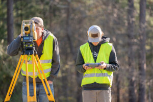
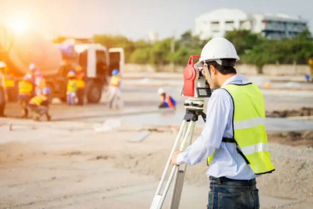
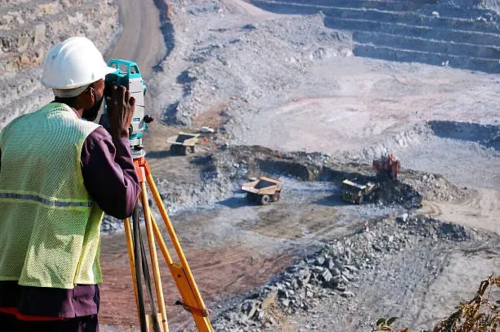
The Role of Engineering Surveyors
Registered surveyors play a crucial role in construction and infrastructure projects, providing expert knowledge in precise measurement and spatial data throughout every stage of development. These professionals carry out important responsibilities:
1. Site Documentation and Analysis
- Conducting detailed topographic surveys
- Determining boundaries
- Documenting as-built conditions
- Performing volumetric calculations
2. Construction Support
- Setting out works
- Verifying building alignment
- Controlling height and level
- Monitoring structures
3. Compliance and Reporting
- Conducting surveys for development applications
- Issuing subdivision certificates
- Carrying out title surveys
- Preparing strata plans
Engineering surveyors use cutting-edge technology such as robotic total stations, GPS systems, and 3D laser scanners to provide measurements accurate to the millimetre. Their expertise covers a wide range of projects including residential developments, commercial construction, and large-scale infrastructure initiatives like roads, railways, and utilities networks.
The meticulous work of engineering surveyors lays the groundwork for effective project planning, design, and implementation. Their comprehensive spatial data facilitates informed decision-making throughout the construction process while ensuring adherence to regulatory obligations and industry benchmarks.
The Role of Utility Locating Teams
Utility locating teams play a crucial role in identifying and mapping underground infrastructure using non-destructive methods. These specialists use advanced detection technologies to create detailed maps of subsurface utilities, such as:
- Water and sewage pipes
- Electrical cables
- Gas lines
- Telecommunications infrastructure
- Stormwater systems
Technologies Used by Utility Locators
To achieve accurate utility detection, these teams employ a combination of specialised technologies:
- Ground Penetrating Radar (GPR) systems
- Electromagnetic locating devices
- Radio detection equipment
- Acoustic detection tools
Services Provided by Professional Utility Locators
Professional utility locators conduct systematic surveys to:
- Identify utility positions and depths
- Map service connections
- Detect potential conflicts
- Document infrastructure conditions
- Create comprehensive utility maps
These teams adhere to strict safety protocols and industry standards to provide precise subsurface utility information. Their expertise helps prevent service strikes, minimise project delays, and protect both workers and infrastructure during construction activities.
The data gathered through utility locating services is vital for project planning, design modifications, and risk assessment in construction and development projects.
Collaboration Process
The partnership between engineering surveyors and utility locating teams forms a strong basis for successful civil engineering projects. This collaborative method combines accurate spatial data with detailed subsurface utility information to create thorough site documentation.
1. Initial Site Assessment
During this phase, both teams work together to gather essential information about the site:
- Engineering surveyors establish control points
- Utility locators conduct preliminary scans
- Joint development of investigation strategy
2. Data Collection Integration
In this phase, real-time sharing of findings and cross-verification of detected utilities take place:
- Real-time sharing of findings
- Cross-verification of detected utilities
- Immediate resolution of discrepancies
3. Documentation Development
Finally, detailed documentation is created by integrating various data sources:
- Creation of detailed 3D utility maps
- Integration with existing survey data
- Quality assurance checks by both teams
This systematic collaboration minimises the risk of utility strikes during construction, reduces project delays, and optimises resource allocation. The combined expertise enables informed design decisions and supports efficient project execution through accurate spatial awareness and comprehensive underground infrastructure mapping.
The collaborative workflow has proven particularly valuable in complex urban environments where multiple utility networks intersect and space constraints demand precise planning and execution. Such scenarios often require adherence to rigorous guidelines as outlined in documents like the USACE Engineer Manual, which provide essential insights into effective engineering practices.
Technologies Used in Utility Locating
Modern utility locating teams use advanced technologies to accurately find and map underground infrastructure. These specialised tools allow for precise identification of subsurface utilities:
1. Ground-Penetrating Radar (GPR)
- Sends high-frequency radio waves into the ground
- Produces detailed images of underground structures
- Finds non-metallic pipes and cables
- Detects disturbances and voids in the soil
2. Electromagnetic Induction (EMI)
- Follows metallic utilities using electromagnetic fields
- Determines the depth and position of conductive materials
- Maps underground power lines and metal pipes
- Provides real-time data on utility locations
3. Vacuum Excavation
- A method of digging that doesn’t cause damage
- Uses high-pressure air or water to expose utilities
- Creates precise inspection holes
- Reduces the risk of harming existing infrastructure
These advanced technologies work together to create comprehensive maps of underground utilities. The information gathered from these methods helps utility locating teams identify potential conflicts and hazards before construction starts. This technological approach supports informed decision-making throughout the project and helps protect existing infrastructure.
Expertise of Engineering Surveyors in Collaboration with Utility Locating Teams
Engineering surveyors bring critical expertise to utility location projects through their specialised knowledge of:
1. Spatial Data Management
- Advanced coordinate systems interpretation
- Precise geospatial mapping techniques
- Digital terrain modelling capabilities
2. Technical Documentation
- Detailed site documentation
- As-built drawing preparation
- Survey control establishment
3. Regulatory Compliance
- Australian Standards for subsurface utility information
- Local council requirements
- Safety regulations adherence
The integration of land surveying expertise with utility location creates comprehensive site intelligence. Engineering surveyors utilise advanced equipment like robotic total stations and RTK GPS systems to achieve millimetre-level accuracy in mapping underground assets.
This precision enables:
- Accurate depth measurements
- 3D modelling of utility networks
- Conflict detection between proposed designs and existing infrastructure
The combined skillset produces detailed subsurface utility engineering (SUE) reports that serve as crucial reference documents for construction planning and risk management strategies.
Successful Collaborations: Project Examples from Telecommunications Sector and School Infrastructure NSW (SINSW) Projects with State Government Agencies
Recent collaborations between engineering surveyors and utility locating teams have delivered exceptional results across major infrastructure projects in NSW.
Telecommunications Sector Success
- CI International and City of Sydney Council projects achieved 100% accuracy in utility mapping through integrated surveying and locating services
- Telstra and NBN installations benefited from precise underground asset identification, preventing service disruptions during construction
- Rapid response teams coordinated utility location and surveying services for emergency telecommunications repairs
School Infrastructure NSW Projects
- Comprehensive site investigations conducted across multiple educational facilities
- Detailed mapping of underground services enabled safe construction of new buildings
- Integration of survey data with utility location findings streamlined planning processes
- Risk mitigation strategies implemented based on accurate subsurface utility data
These collaborative projects demonstrate the practical benefits of combining surveying expertise with utility location services. The successful completion of these projects has established new standards for infrastructure development in NSW, particularly in sensitive areas requiring precise underground asset management.
See Also : Surveyors in Brisbane: Choosing Professionals for Site and Utility Surveys
Benefits of Collaboration for Project Efficiency and Risk Minimisation while Ensuring Compliance with Regulations
The strategic collaboration between engineering surveyors and utility locating teams creates substantial benefits for construction projects:
Risk Management Benefits:
- Reduced likelihood of utility strikes and service interruptions
- Minimised potential for workplace accidents
- Lower project insurance premiums
- Protected underground assets and infrastructure
Efficiency Advantages:
- Streamlined project timelines through coordinated workflows
- Reduced need for rework or project modifications
- Optimised resource allocation and equipment utilisation
- Enhanced decision-making based on comprehensive site data
Regulatory Compliance:
- Adherence to Dial Before You Dig requirements
- Compliance with AS5488-2019 Classification of Subsurface Utility Information
- Meeting local council and state authority regulations
- Documentation aligned with industry standards
The integration of surveying expertise with utility detection capabilities enables precise mapping and documentation of underground services. This systematic approach helps project managers maintain control over costs while meeting safety requirements and regulatory obligations. The resulting efficiencies translate into tangible benefits for stakeholders across the project lifecycle.
Future Prospects: Role of Multidisciplinary Approaches in Infrastructure Systems Design and Development
The integration of advanced technologies and multidisciplinary approaches shapes the future landscape of infrastructure systems design. Modern infrastructure projects demand a convergence of expertise from diverse fields:
- Digital Twin Technology – Creating virtual replicas of physical infrastructure enables real-time monitoring and predictive maintenance
- AI-Powered Analysis – Machine learning algorithms enhance utility mapping accuracy and infrastructure planning
- Sustainable Design Integration – Environmental specialists work alongside engineers to create eco-friendly infrastructure solutions
- Smart City Integration – Connected infrastructure systems require collaboration between IT specialists, urban planners, and surveyors
The rise of complex underground utility networks and smart city initiatives necessitates cross-disciplinary collaboration. Engineering surveyors and utility locating teams adapt to incorporate:
- Advanced 3D mapping technologies
- Real-time data sharing platforms
- Automated documentation systems
- Cloud-based collaboration tools
These technological advancements create opportunities for enhanced project outcomes through integrated approaches to infrastructure design and development. The combination of traditional surveying expertise with cutting-edge utility location methods establishes new standards for infrastructure project delivery.
Conclusion
The collaboration between engineering surveyors and utility locating teams is crucial for modern infrastructure development. This partnership ensures accurate mapping, improved safety measures, and efficient project execution. By combining advanced technologies with expert knowledge, a strong foundation for successful project outcomes is created.
The success seen in telecommunications and educational infrastructure projects demonstrates the effectiveness of this collaborative approach. As infrastructure demands become more complex, this partnership becomes even more important. Companies like Wumara Group show how this collaboration can achieve outstanding results while also respecting regulations and engaging Indigenous communities in the construction industry.
This proven model of collaboration sets new standards for infrastructure development across NSW and QLD, ensuring projects meet both technical excellence and community needs.